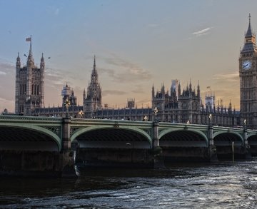
Situated between the Cotswold Area of Outstanding Natural Beauty and the Forest of Dean, with a range of parks and canal side walking routes within the city, Gloucester is an ideal location to buy or rent a property.
With a diverse range of properties on offer, Gloucester is also close to the M5 motorway and is handily connected to the Midlands, southwest and London.
If you're considering moving to Gloucester, here is our guide to some areas that you may want to explore in the search for your dream home.
Property Centre Guide on Moving to Gloucester, The County Town of Gloucestershire
Abbeydale and Abbeymead
Abbeydale and Abbeymead are modern suburbs of Gloucester that lie approximately three miles southeast of the city centre.
Although these suburbs are located side-by-side they are distinct from each other with their own unique qualities. There is a well-defined border between the two communities that sets them apart.
Abbeydale
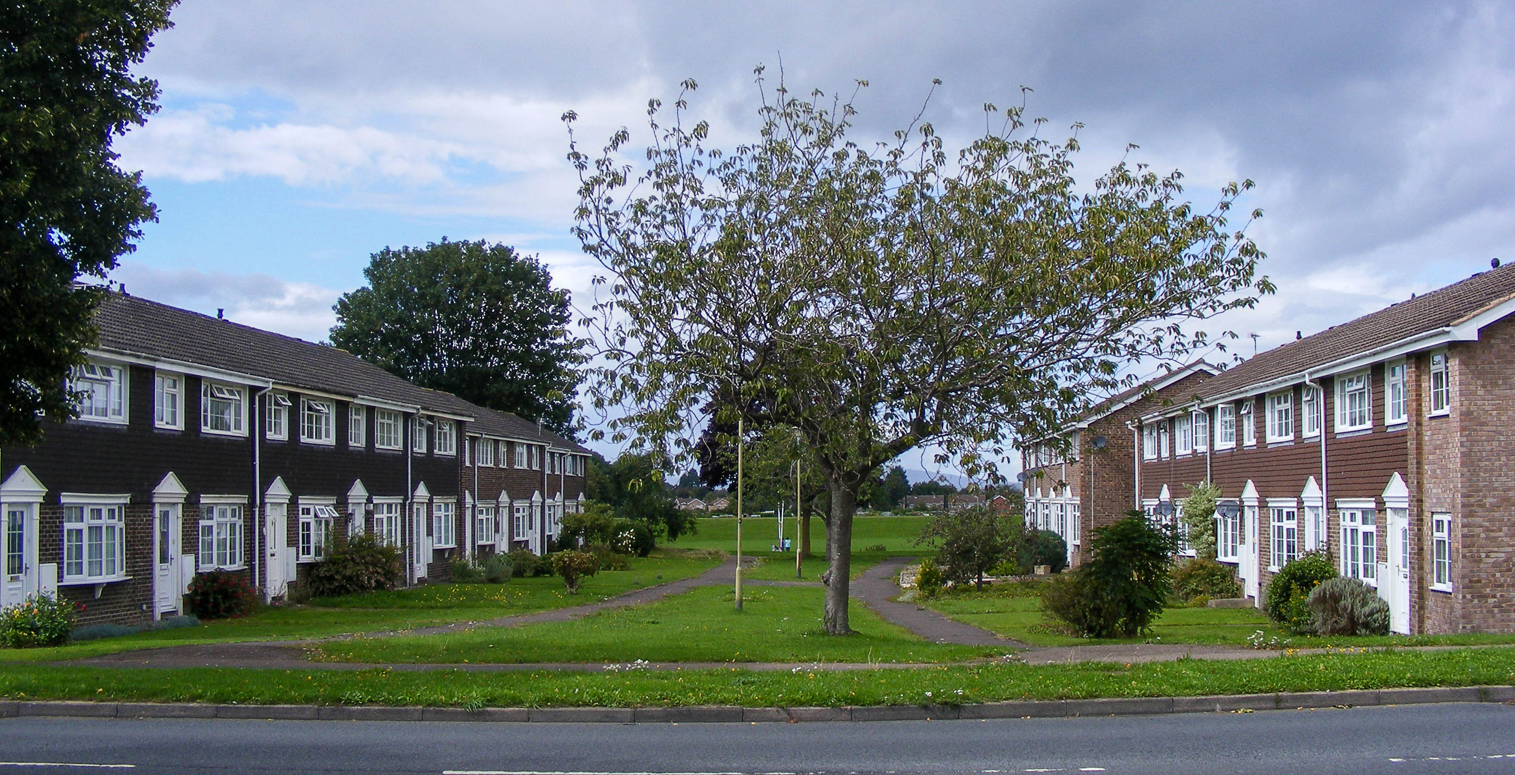
By 1970, the once vast expanse of green fields that made up Abbeydale had been replaced with Heron Park - a residential development created by Heron Homesteads. During this time period, it was referred to as 'The Land to the East'.
 By AmosWolfe - Own work, CC BY-SA 4.0
Heron Park is designed to follow the Radburn model, consisting of loops and cul-de-sacs radiating from Heron Way. This central spine road provides access to the rear of homes where garages and hard standings are located.
Those living in the residences have their homes facing one another along interlocking routes and open areas, thus removing pedestrians from roads. In homage to the developer's brand, the streets were named after British birds.
This area is similar to the Heron development in Yate, South Gloucestershire which was constructed around the same time and includes its own Heron Way.
In the mid-1970s, Abbeydale's completion began with construction on a vast expanse of land situated between Heron Park and the M5.
These homes were constructed by the Robert Hitchins and Glevum Estates and are distinguished from Heron Park by their more conventional layout and different house designs. Most houses face the road, have front driveways and garages, and are similar to those built by the same companies in Quedgeley.
Abbeymead
In 1986, housing construction started on agricultural land between Abbeydale and Barnwood and soon became known as Abbeymead.
Abbeydale was connected to the city of Gloucester by the construction of Abbeymead Avenue, otherwise known as the Eastern Radial Road. The plan for this thoroughfare included a flyover across Eastern Avenue; however, it never came to fruition.
In order to ensure road safety for its residents, Abbeymead Avenue was established with an original speed limit of 40 mph with no houses facing directly onto the road. With many smaller projects being added over time, this area has now become one of the more populous suburbs of Gloucester.
Lobleys Drive is an essential roadway located off Abbeymead Avenue, that gives drivers access to the M5 and into Coopers Edge development as well as Brockworth Trading Estate.
Barnwood
Barnwood, located 1.8 miles from the heart of Gloucester, was formerly a small hamlet on an ancient Roman route that connected Hucclecote, Brockworth and Cirencester to the city.
Nestled in the grounds of the Barnwood House Hospital, which was closed and later demolished, is what we know today as Barnwood Arboretum. Under expert care by Gloucester City Council alongside the Friends of Barnwood Arboretum, this lush woodland area has been enclosed to protect its natural beauty for generations to come.
The Arboretum, beautifully located off Church Lane in Barnwood, offers a stunning array of habitats such as grasslands and wetlands. Surrounded by majestic native trees and exotic flora species, it's the perfect place to escape into nature.
Barton and Tredworth
Barton and Tredworth lie just outside the Eastgate of the city.
This area is home to up to 45 distinct communities, with as many as 50 languages being spoken amongst them.
Barton and Tredworth are working together on an ambitious project to document the stories of locals, both past and present. In addition, Barton is one of only a few locations in England that still elects a Mock Mayor.
Coopers Edge
Nestled at the base of Coopers Hill, Coopers Edge emerged in 2007 as a brand-new residential area between Gloucester and Cheltenham. The suburb's construction has taken place within Brockworth since its initial build commenced sixteen years ago.
 © Copyright Colin Manton and licensed for reuse under this Creative Commons Licence
Coopers Edge is located amidst a stunning landscape and offers easy access to various walking, cycling, and bridleways. The area has excellent road connections with the M5 motorway only two miles away as well as the A419 leading to Swindon that connects with the A40 for travel towards Oxford.
Coopers Edge is just a stone's throw away from the bustling business park, massive superstore and recently established Whittle Square that features an array of retail stores, restaurants, pubs and a gym.
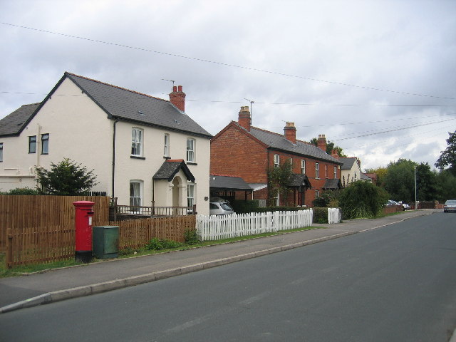
Hempsted
An ancient area of Gloucester, Hempsted was located just outside the city.
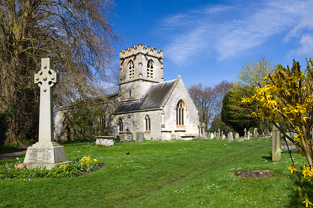 Photo © Mike Searle (cc-by-sa/2.0)
Constructed and funded by the Norman nobility, St. Swithun's elegant building stands as a testament to their wealth and power. A notable feature of the churchyard is John Freeman's chest tomb - a prominent Royalist officer killed during the Siege of Gloucester in 1643.
In the Middle Ages, an Augustinian monastic order that had been facing persecution in Wales found refuge with the city's blessing. To commemorate this new beginning, they founded Llanthony Secunda Priory and made Hempsted its home.
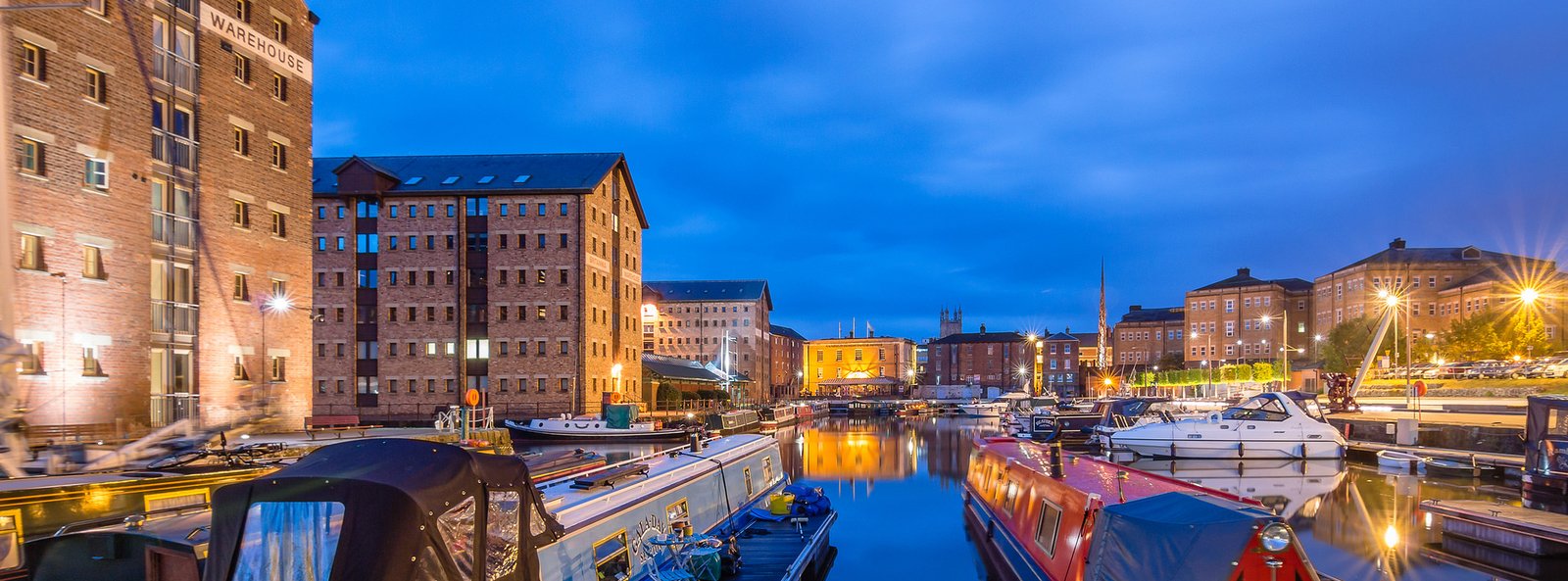
High Orchard
In the 19th century, High Orchard was born from humble beginnings as the home of the pastoral orchard of Llanthony Secunda. Over time it became an industrial hub bustling with activity.
Tied to the Gloucester Docks and connected by both, the Gloucester and Sharpness Canal as well as the railway, this area was home to Fielding & Platt's Atlas Works (among other large industries). As such, it rapidly grew in importance for local residents.
High Orchard underwent an extensive redevelopment in the early 2000s to create Gloucester Quays Shopping Centre. Despite many alterations, some of the existing buildings were preserved on the canal side and either incorporated within the mall or completed as luxury apartments.
In 2017, four historic dockers' cottages in High Orchard Street were put up for sale after undergoing a complete renovation. Constructed in 1902 for employees of the Malsters Warehouse next door, these dwellings are now some of the last surviving buildings from that era.
Hucclecote
Hucclecote is situated on the outskirts of Gloucester, between Barnwood and Brockworth along Ermin Way - a historic Roman path which connects to Cirencester and the Cotswolds.
Prior to World War II's outbreak in 1939, Hucclecote was merely a small village. As the war broke out, development stopped and unfortunately the area suffered from targeted bombing by Luftwaffe due to its aircraft factories and industrial facilities which were formerly part of Brockworth.
Due to redistricting, the site of the airfield from which the world's first jet fighter, the Gloster Meteor, took off for test flights is now within the boundary of Hucclecote.
The Brockworth area has experienced a remarkable transformation, with the plot of land that was once occupied by the airfield and factory being converted into Coopers Edge. This housing development includes 1,900 homes as well as retail outlets and a school.
Hucclecote is divided by the M5 Motorway bridge, with the western side nearer to Gloucester being much larger and governed under Gloucester City Council. The eastern section of Hucclecote falls within Tewkesbury Borough Council.
Hunts Grove
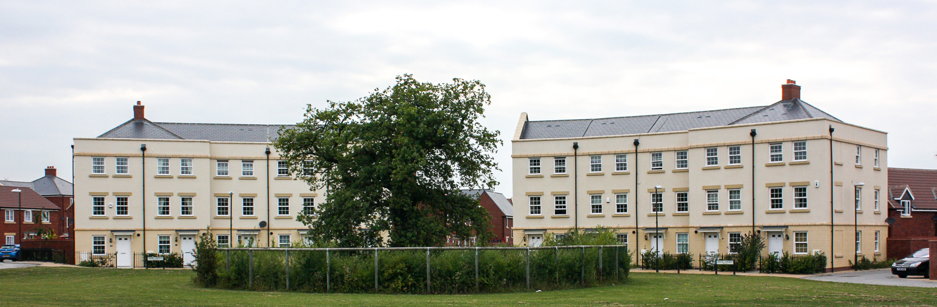
Enjoying a coveted location on the outskirts of town, Hunts Grove is a new development nestled between Hardwicke and Haresfield villages.
Construction commenced in 2010, and certain phases of the Hunts Grove development are still under construction. The development is aptly named after the quaint woodland area on the site.
The location of Hunts Grove, once home to Colethrop Farm in the Hardwicke and Haresfield parishes of the Stroud district, became a parish in its own right in April 2020.
Innsworth
Innsworth is a civil parish and forms part of the borough of Tewkesbury.
Innsworth is home to the Imjin Barracks, which houses the Allied Rapid Reaction Corps. The barracks welcomed its new tenants in 2010 after they moved from Germany, and up until 2008 it was well-known for housing RAF Personnel and Training Command before their relocation to High Wycombe.
Innsworth and its neighbouring town, Churchdown, are separated into two halves. The military housing side ends at the intersection of Ward Avenue and Swallow Crescent and the junction of Thompson Way with Swallow Crescent.
Many of the dwellings in Innsworth were either prefabs or quickly constructed "no-fines" structures, typical for the mid-to-late 1940s following World War II. Initially intended to be standing for around 20 years, some of these properties remain today. A majority have had their original concrete replaced with contemporary brick walls; however, there are still a few distinctive Wimpey and prefab homes that remain unchanged.
These homes and bungalows, like many of the developments at this time, are located on roads named after a specific theme - in this case, birds. Subsequent housing projects in the village continued with that tradition; Tern Court is situated towards the north side of Rookery Road while Falcon Close lies less than 100 yards away.
Kingsway
Just three miles south of the City, Kingsway Village lies in close proximity to the suburbs of Quedgeley and Tuffley.
Built on land occupied by the former RAF Quedgeley between 1914 to 1995, Kingsway was constructed in 2006 by a consortium of developers including Barratt Homes, Bromford Group, Bryant Homes, David Wilson Homes, George Wimpey, Miller Homes, Persimmon plc and Taylor Wimpey.
The Kingsway Residents Association, founded by Barry Kirby and Clive Barton in June 2008, is a thriving organisation that arranges public meetings, fun days for the community and other local events. It also advocates on behalf of its residents to local government as well as organisations playing a part in the area's growth.
Many NATO military families who are now based at HQ Allied Rapid Reaction Corps in Innsworth have moved to the area.
Longlevens
Longlevens, originally Longleavens, developed from a farmstead during the twentieth century.
The name Longlevens is believed to be based on either the old Roman name Colonia Glevensis or a local field known as "Long Elevens" which was eleven acres in size.
Longlevens is primarily residential and is home to Sir Thomas Rich's School, Holy Trinity Church, Kendal Road Baptist Church, Longlevens Junior School, Longlevens Infants School and various shops.
For five decades, Longlevens hosted the bustling Gloucester & Cheltenham Stadium for greyhound racing. Though closed in 1983, its legacy remains with the Greyhound Inn now occupying the site and a road still bearing its name - Greyhound Gardens.
Longlevens is home to the highly successful semi-professional team, Longlevens AFC. This club offers numerous adult, women's, youth and junior teams at three different sites: Innsworth Lane, Longford Lane and Longlevens Infant School.
Matson
In contrast to nearby villages like Brookthorpe and Upton St Leonards, Matson is not mentioned in the Domesday Book. Most likely it was a component of Kings Barton during that time. It's still uncertain where its name came from; early versions included Matesknolle, Mattesdune, and even Matesden.
Matson, known for the housing estate that was built in the village after the Second World War, is bordered primarily by Robinswood Hill, a large hill that rises to 283 metres above sea level. Much of Matson is built on the sides of the hill, which also features the Gloucester Ski Centre.
Matson House, a grand manor house, was the strategic base of operations for King Charles during the Siege of Gloucester. In 1679 it became Major General William Selwyn's property and is now home to Selwyn Care Home.
Tom Kerridge, a renowned celebrity chef, dubbed his "expensive" curry sauce after the one he customarily bought from his local chip shop on the Matson estate.
Moreland
This electoral ward of Gloucester, colloquially known as Linden is named after the Moreland match factory.
Samuel J. Moreland, son of a sawyer from Stroud, moved to Gloucester in 1867 and opened the Moreland factory which still stands today on Bristol Road to manufacture England's Glory matches.
Podsmead
Podsmead is a district of Gloucester approximately one mile from the city centre.
Podsmead experienced a dramatic expansion during the twentieth century, with grand houses mirroring those found in Tuffley emerging during the interwar period. After The Second World War, an array of short-term residences and social housing was erected to meet the growing demand for new homes.
 © Copyright Jonathan Billinger and licensed for reuse under this Creative Commons Licence
In 1943 the Crypt School moved to its present home in Podsmead.
Quedgeley
Quedgeley is a suburban town of Gloucester, located 3.5 miles southwest of the city centre.
The establishment of the Quedgeley parish dates back to around 1095 when St. James Church was constructed. It is thought that it resulted from the merging of several other parishes in the area. In its early days, houses were situated along a former Roman road between Gloucester and Bristol - now known as B4008 Bristol Road - which served as a frequent stop for travellers passing through on their journey.
The town of Quedgeley is bounded to the east by Daniels Brook, which separates it from Tuffley. To its west and south lies the River Severn and Dimore Brook, marking off Elmore and Hardwicke as its neighbours.
Since the 1980s Quedgeley has become increasingly contiguous with Gloucester and is now the city's largest southern suburb. The civil parish of Quedgeley was transferred to Gloucester district in 1991 and is the only town within the city.
Tuffley
Tuffley also recorded as Tufley, Tufly, Tuffel was mentioned in the Domesday Book of 1086 as 'Tuffelege'.
The name is believed to be derived from an Anglo-Saxon personal name; "Tuffa" coupled with the suffix ‘leah’ meaning fenced enclosure or farm - suggesting that it was once a village referred to as "Tuffa's Farm."
Located in close proximity to Robinswood Hill, the ward is a largely residential, unparished area with a plethora of amenities including schools, retail stores, and parks.
White City
White City derives its moniker from the concrete dwellings of white colour that were initially constructed there.
After World War I, a national initiative began to replace the dilapidated housing in city centres with better quality homes for working-class families. Land nearby that had been previously used as model dwellings back in 1914 was chosen for this new endeavour and became known as Northfield Road and Northfield Square.
In 1927, Gloucester Corporation seized Starveall Farm via compulsory purchase to create White City - which would eventually provide these much-needed houses. The estate was formally opened by the Duke of Gloucester, in a tree-planting ceremony in 1928.
The roads on the estate are inspired by both Gloucestershire villages and characters from Charles Dickens who graced Gloucester docks in the 1850s. In the early 90s, Gloucester City Council demolished the older homes and these were replaced with new residences constructed by Oxbode Housing Association and Beazer.
Despite its history, White City did not appear on any official maps of Gloucester. Residents of the area successfully campaigned for their neighbourhood to be recognised officially as a district of the City, and to appear on maps and road signs.
In October 2012, the present Duke of Gloucester was invited back to mark White City’s new standing.
When it comes to property, Gloucester has a lot to offer. The Property Centre is a leading local estate agent with five branches located around the city.
With expert local knowledge of Gloucester and the surrounding areas, we can provide expert advice as to which areas are best to help you find your ideal home.
Whether you're looking for a house with character in a rural area or a modern apartment close to amenities, we have an extensive selection of properties available so you're sure to find something that meets your needs.
Contact your local office today for more information.